Infrastructure
Planning and development services for infrastructure that support connectivity, mobility, and development needs safely, efficiently, and sustainably.
Civil & Infrastructure
INFRASTRUCTURE
Infrastructure consultancy services covering existing condition surveys, geometric and pavement design, as well as hydrological analysis to produce safe, effective, and site-appropriate infrastructure designs.
Objective:
- Acquire accurate surface condition and elevation data of the land.
- Determine contours, slopes, site boundaries, and existing conditions.
- Provide baseline data for building, road, drainage, and other infrastructure planning.
- Support grading, cut & fill planning, and earthwork operations.
- Serve as a reference for design drawings and existing condition modeling.
Scope of Services:
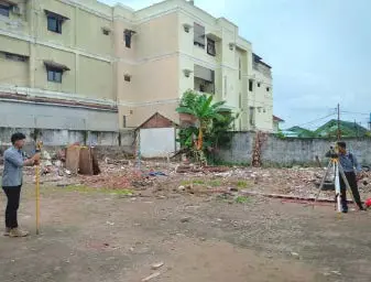
- Preparation, site survey, and coordinate/elevation measurements using surveying equipment.
- Measurement of detail points, spot elevations, benchmarks, and control points.
- Identification of existing conditions (roads, buildings, channels, utilities, and other site features).
- Processing survey data, compilation of topographic maps, contours, digital terrain models, and CAD/GIS formats.
Requirements / Preparedness:
- Site plan/layout and clear site boundary limits.
- Existing coordinate and benchmark data if available.
- Information on planned construction/infrastructure, existing utilities/facilities, and site access permits.
Objective:
- Design road pavement structures matching soil conditions and traffic loads.
- Determine the optimal type and thickness of each pavement layer.
- Ensure roads possess adequate structural capacity and service life.
- Optimize material usage, construction costs, and long-term safe and comfortable performance.
Scope of Services:
- Collection & review of existing data, subgrade analysis, CBR, and geotechnical parameters.
- Traffic volume/characteristic analysis, determination of design parameters & design life.
- Selection of pavement type (flexible/rigid pavement) and layer thickness calculation.
- Drainage evaluation, detailed design preparation, technical drawings, technical specifications, and quantity calculations.
Requirements / Preparedness:
- Site plan, road alignment, topographical data, traffic count, soil investigation, & subgrade CBR.
- Construction material data, vehicle loads, design life, design standards, & existing drainage conditions.
Objective:
- Analyze rainfall and surface runoff characteristics within the project area.
- Determine design discharge for drainage and water control systems.
- Prevent water pooling and mitigate flood risks in the project area.
- Determine the capacity of channels, culverts, retention ponds, and water control structures.
- Support infrastructure planning safe against local hydrological conditions.
Scope of Services:
- Collection/analysis of historical rainfall & catchment area characteristics.
- Analysis of intensity, return periods, design rainfall calculation, design discharge, & surface runoff.
- Planning of drainage systems, channel capacity, culverts, and retention/detention ponds if necessary.
- Integration of hydrological design with topography/infrastructure, report preparation, & technical drawings.
Requirements / Preparedness:
- Site plan, area boundaries, topography/elevation data, & historical rainfall data from the nearest station.
- Land use info, catchment area, existing channels, outlet points, flood history data, & design standards.